Editorial Summary
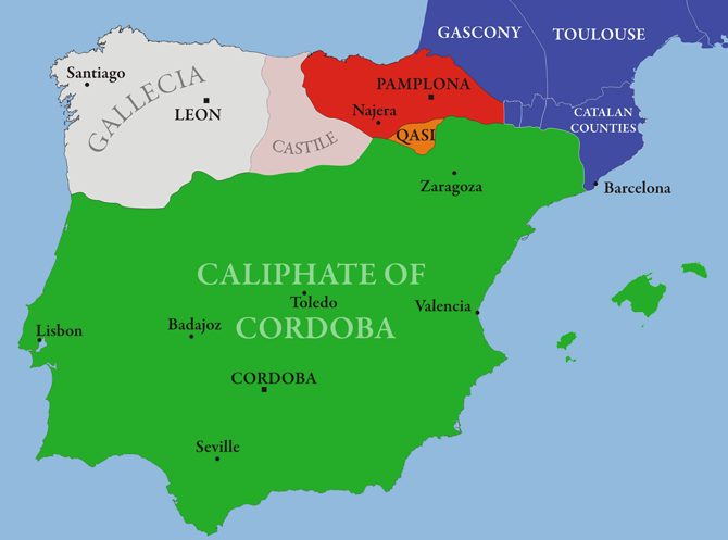
A map helps readers see space quickly. It can show routes, cities, coastlines, frontier zones, and the relationship between Iberia, North Africa, and the wider Mediterranean. But a map is never the whole territory.
Moor History Center uses maps as visual guides, not as shortcuts around evidence. A border line can make a complicated political situation look cleaner than it was. A color block can hide local autonomy, mixed rule, shifting tribute, contested frontier zones, and the difference between military control and everyday life.
That is why maps are so useful and so dangerous at the same time. They make argument feel settled before the reader has asked what kind of map they are actually looking at.
What A Map Can Help Prove
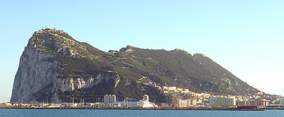
Maps can be useful evidence for geography and framing. They help readers locate Cordoba, Toledo, Granada, Gibraltar, Ceuta, Fez, Marrakesh, and other places in relation to one another.
They can also help explain why words shift. Al-Andalus, Iberia, the Maghreb, Morocco, North Africa, and Spain are not interchangeable labels. Each term belongs to a particular frame of reference.
Maps are especially strong when the question is spatial: how far is Granada from Marrakesh, where is the Strait in relation to major cities, which regions sit on a frontier, which routes connect inland centers to ports, and how do different political centers face one another across the western Mediterranean.
What A Map Cannot Prove Alone
A map cannot prove that every person inside a color block had the same identity, language, religion, ancestry, or political loyalty. It cannot prove that a ruler controlled every village equally. It cannot prove that a modern national label applied in the same way in the medieval period.
This matters because many viral claims use map images as if they settle questions about race, descent, sovereignty, or civilization. The image may be useful, but the claim still has to be tested.
Maps also compress time. A single teaching map may summarize a century of change in one still image. If the reader forgets that compression, the image quietly turns movement into permanence.
Three Questions To Ask
First, ask the date. A map of 756 is not a map of 929, 1031, 1212, or 1492.
Second, ask the layer. Is the map showing dynasties, cities, military campaigns, language zones, religious communities, trade routes, or modern national boundaries?
Third, ask the source. Is the map a modern teaching map, a medieval geographic work, a reconstruction from scholarship, or a popular graphic without citation?
Two Common Map Mistakes
The first mistake is reading a border as if it were equally real at every point on the ground. Medieval frontiers were often zones of negotiation, tribute, raiding, and partial authority rather than clean modern state lines.
The second mistake is mistaking map scope for social proof. A large shaded area does not prove uniform rule, equal penetration, or shared identity. It proves only that the mapmaker wants to represent a territorial claim in that way.
A Better Way To Use Maps
Use a map to form a sharper question:
- Which city or region is the claim about?
- Which century is under discussion?
- Which dynasty, ruler, or local community matters?
- Does the map show direct rule, influence, movement, memory, or later interpretation?
Then move from the map into sources, places, events, and claim checks.
One practical habit helps here: never stop with the map. Pair it with at least one text, one place-specific article, or one timeline entry. That immediately reduces the chance that a visual summary will be mistaken for final proof.
Working Conclusion
Maps are powerful because they make history visible. They are also risky because they make uncertainty look neat. Read them as invitations to verify, not as final proof.