Place Summary
A North African port city near the Strait of Gibraltar, important to later traditions about the 711 crossing into Iberia.
Why This Place Matters
Ceuta keeps the 711 story anchored on the North African shore. It was a port, crossing point, and strategic threshold where Maghrebi, Mediterranean, and Iberian histories meet.
Historical Context
Ceuta's position near the Strait made it important for movement between Africa and Iberia. Later traditions around the crossing into Iberia often place nearby North African ports inside the origin story, but the port's history is larger than that single episode.
It also helps readers link maritime routes, Maghrebi politics, and trans-Saharan connections without treating North Africa as only a background to al-Andalus.
That is the key value of Ceuta on this site. It teaches readers to think in corridors rather than borders. The strait was a zone of movement, control, uncertainty, and connection, and Ceuta helps make that geography concrete on the African shore.
Visual Reading Notes
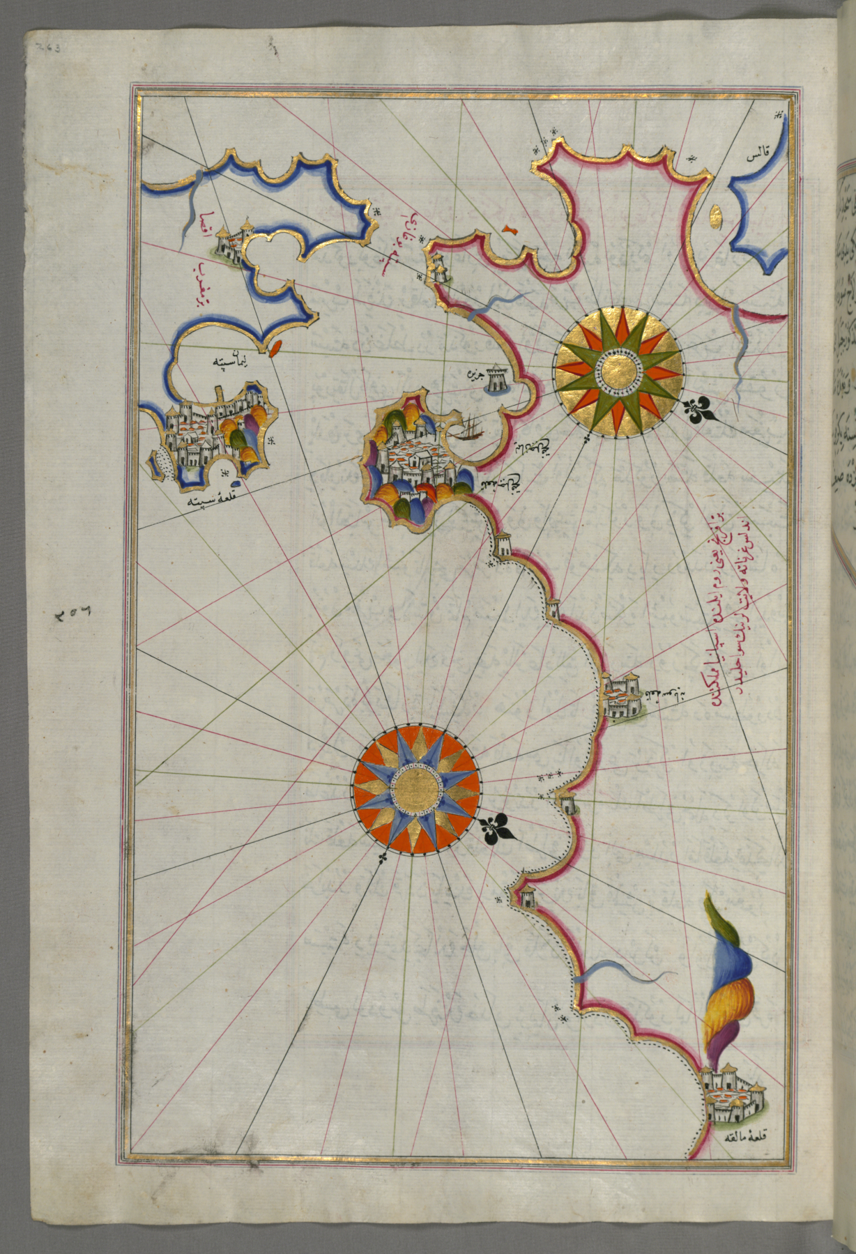
The Piri Reis map is a later visual source, not a 711 eyewitness record.
Useful questions:
- What period does the map represent?
- Is the claim about geography, port strategy, trade, or conquest memory?
- How does Ceuta connect with Gibraltar and Tangier?
Evidence Frame
Ceuta is useful for route logic, but place-based memory can outgrow documentation. Separate the site's strategic geography from later narrative details about who crossed, when, and under what exact circumstances.
In practice, the place should anchor cautious spatial reasoning. It can show why a crossing story is plausible and strategically meaningful, but it cannot by itself settle every disputed detail in later origin narratives.
Readers should also avoid reducing Ceuta to a prologue. The port matters not only because it may appear in stories about 711, but because it belonged to wider systems of trade, intelligence, diplomacy, and military movement across the strait. That broader role makes the site more historically useful than a single origin anecdote.
What to Look For
- Strait geography and port movement.
- Links to Gibraltar, Tangier, and Fez.
- North Africa as an active historical setting.
- Trade, military, and diplomatic uses of ports.
- Later maps as evidence from their own period.
Related Reading
Read Ceuta with Gibraltar and Tangier, then move into the 711 crossing article. For deeper context, use the Maghreb-before-al-Andalus and trans-Saharan routes pages.
What This Place Should Teach
Ceuta should teach readers to think in corridors rather than continents. The Strait was not a hard civilizational divide; it was a channel through which ships, armies, merchants, and stories moved. Once that becomes clear, North Africa stops looking like background scenery and starts looking like an active half of the historical system.